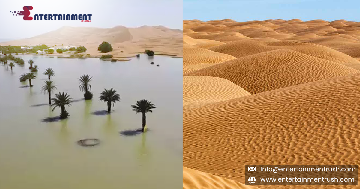
The abnormal rainfall that has hit the Sahara desert after many decades changed the anatomy of the Sahara desert with several attractive changes in its view. Before, the Sahara was a deadly place if you were stuck there and that is why people chose not to go there, now has become a place of attraction for nature wanderers. This has become a tourist spot now because tourists are not curious to see how the Sahara is changing due to excessive rain over there. The palm trees, the dunes and the presence of water in the Sahara have also welcomed different species over there. According to the satellite images from NASA, the Sahara is showing a blend of beautiful sceneries from an aerial view. This seems like a newly discovered land on Earth. At the same time, it had brought destruction too, but that is in control now.
Sahara is the desert where there was never any sign of the water or flooding. However, in the recent striking images from the Sahara desert, floods can be seen in the dunes after one of the most arid and barren places in the world was hit with its first floods in decades.
Sahara is a desert where rain does not fall regularly, not even occasionally, but if it happens, then it’s in the late summer or in the middle of the season which is measured up to some inches. However, in September for over two days, intense rain took place in southeast Morocco, when a low-pressure system pushed across the northwestern Sahara.
According to NASA’s data, rain recorded is 8 inches in some parts of the Sahara region.
Errachidia is a desert city in southeast Morocco where rain recorded is up to 3 inches of rainfall, most of it covered in only two days, this is estimated to be more than usual that happens in the Sahara.
A member from Morocco’s meteorology agency, ‘Houssine Youabeb, said,’’ We have not seen this type of rain in the Sahara since 30 to 50 years ago,
This excessive rain over the desert has changed the area a little bit, it created a new, watery landscape amid the palm trees and thickly waxed flora.
The shadows and their reflections on the town’s palm trees now shimmer across the shades of a new lagoon, surrounded and caped by steep sand dunes.
The recent rain has filled lakes that are usually dry, including one in Iriqui National Park, Morocco’s largest national park. NASA’s satellite images, which use false color to highlight the floodwaters, reveal newly-formed lakes across large areas of the northwest Sahara.
While much of the rainfall occurred in sparsely populated remote regions, some fell on Morocco’s towns and villages, leading to deadly flooding last month that claimed the lives of over a dozen people.
The Sahara is the world’s largest non-polar desert, covering 3.6 million square miles. Satellite images from September showed vast areas of the desert turned green as storms moved further north than normal, a trend that some studies have linked to human-induced climate change.
Recent research suggests that the Sahara could experience more extreme rainfall events in the future as fossil fuel pollution continues to warm the planet and disrupt the water cycle.
